
Fair Lawn ZIP Code Directory Coverage
Fair Lawn's documented five-digit postal ZIP is 07410. The source review did not verify a second five-digit ZIP serving a Fair Lawn parcel, and it found no official internal neighborhood ZIP map. That makes the Fair Lawn ZIP code directory a one-ZIP orientation tool, not a way to divide the borough into separate residential zones. Multiple postal facilities use the same 07410 base ZIP. Their longer ZIP+4 forms identify delivery routing for those facilities, not three more ZIP codes or three separate municipalities.
| ZIP Code | Areas Covered | Post Office | Notes |
|---|---|---|---|
| 07410 | Postal addresses associated with Fair Lawn | Fair Lawn, River Road, and Warren Point facilities | One documented five-digit ZIP; facility ZIP+4 references are routing details |
The main Fair Lawn Post Office is listed at 14-24 Abbott Road with 07410-9998. River Road is listed at 12-44 River Road with 07410-9991, and Warren Point is listed at 30-10 Broadway with 07410-9993. Those suffixes should stay attached to the source address when cited. They do not identify a neighborhood, a parcel district, or a resident group.
The USPS Fair Lawn Post Office record is shown below. It supplies the facility and ZIP+4 example used to explain the base ZIP.
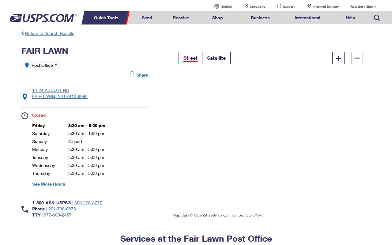
The postal record helps format and confirm a facility address. It does not return an occupant list, a legal borough boundary, or proof that a person lives at an address.
Fair Lawn ZIP+4 Station Labels
A ZIP+4 adds four digits to a five-digit ZIP for mail sorting and delivery routing. In Fair Lawn, the documented facility examples all retain the 07410 base. A reader who sees 07410-9991, 07410-9993, or 07410-9998 should read the first five digits as the postal ZIP and the last four as a routing detail for that address. Do not convert a facility suffix into a separate place name or use it to infer where a household belongs.
The USPS River Road station record is another documented 07410 facility reference. It demonstrates why the suffix must be read with the full station address.
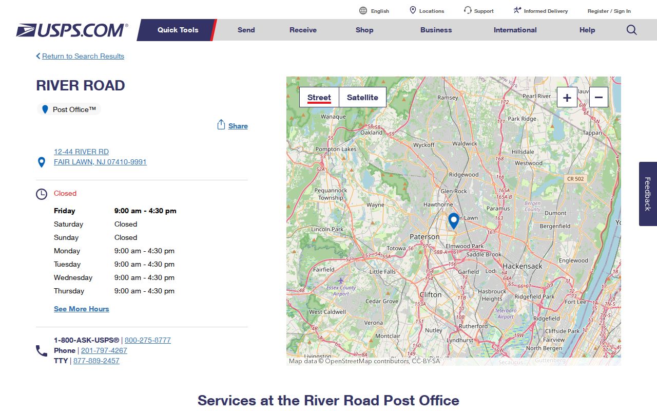
Use a station page to check the exact facility cited by a source. Use a parcel map or borough record to determine whether a different address is actually inside Fair Lawn.
Fair Lawn ZIP Code Map Inputs
Once an exact address is known, leave the ZIP code directory and use a parcel source. New Jersey's Property Explorer accepts address, county, municipality, block, and lot inputs, and supports map clicking. Select Bergen County and Fair Lawn Borough when the source supplies enough detail. The service is useful for parcel orientation, but its hosted and downloaded owner-name data can be redacted under Daniel's Law. A blank owner field is a privacy or data-publication condition, not evidence that no owner exists.
| Property Explorer field | Input type | How it helps after a ZIP check |
|---|---|---|
| Address | Text or autocomplete | Moves from a postal address to a parcel search. |
| County and municipality | Filters | Limits the search to Bergen County and Fair Lawn Borough. |
| Block and lot | Text or numeric | Uses the local parcel identifier for map and record follow-up. |
| Map click or browse | Map interaction | Opens an available parcel and its visible attributes. |
The NJGIN parcel and map entry point is shown below. It leads to the current statewide parcel resources and notices about service updates.
Record the map layer, visible update date, access date, and parcel identifiers. Parcel geometry can change between releases, and a map polygon is not a survey or a deed.
Find Fair Lawn Residents by ZIP Code
No official Fair Lawn name-and-address directory was verified for a ZIP-wide search. The reliable route starts with a postal address, not a surname. USPS confirms the postal form; NJGIN or the Bergen County Parcel Viewer helps identify the legal municipality and block and lot; the local assessor is the fallback for current assessment questions. This separates orientation from proof. A ZIP alone is weaker than a parcel identifier, a dated directory entry, or a recorded document.
- Confirm the exact address and five-digit ZIP through a USPS address or facility source.
- Search the address in NJGIN Property Explorer or Bergen County's parcel viewer, selecting Bergen County and Fair Lawn Borough where appropriate.
- Copy the street form, municipality, block, and lot exactly as returned by the map or assessment record.
- For a specific historic person or household, compare a dated directory, newspaper, census, or deed rather than treating the ZIP as a resident list.
- When the task becomes a street-by-street question, use the Fair Lawn street directory record chain.
The Borough Tax Assessor is the local contact for current ownership and assessment questions. Its public page does not provide a general owner-name lookup, and the statewide map's visible data may be redacted. Contact the office with the street address or block and lot, rather than attempting to reconstruct protected information from a ZIP label.
Fair Lawn ZIP Code Record Requests
Voter material is not a ZIP code resident directory. New Jersey's public registration status check requires the person's exact registered first name, last name, and date of birth. It is a self-status tool, not a public surname browser and not address-history proof. For a dated election record, Bergen County voter lists are a separate written-request channel. Ask for the election or list type, municipality, district range, date, format, available redactions, and whether a street address is included before paying.
The Bergen County Clerk voter-list service lists $0.25 per district for voter lists and $0.25 per page for mailing lists. A focused request is better than an undefined request for all voter records. The county election office may be the proper custodian for some material, and a request should be sent to the named custodian if the Clerk refers it there.
For borough records with no online index, the Fair Lawn Municipal Clerk is the OPRA custodian. The Fair Lawn OPRA form supports email, pick-up, mail, on-site inspection, and fax delivery choices. Identify a particular record, date range, and department. OPRA does not require an office to create a new ZIP-to-person crosswalk.
Fair Lawn ZIP Code Names Across Time
Postal and municipal labels do not stay fixed across history. Fair Lawn was incorporated as Fairlawn in 1924 from part of Saddle River Township, then changed to the two-word spelling in 1933. A historical directory, newspaper, deed, or census may use Fairlawn, Saddle River Township, a postal town label, or a nearby community name. Keep the source label exactly as it appears, then use the date, a parcel source, and the borough history to interpret it.
That caution matters near Fair Lawn's borders with neighboring municipalities. A mailing label can refer to a postal service area that differs from the legal municipality. A historical location called Radburn is a community or neighborhood label, not a separate municipality. Preserve it as a search term, but confirm the legal municipality through a parcel or official boundary source.
Fair Lawn ZIP Code Boundaries
ZIP boundaries and borough boundaries serve different purposes. The five-digit 07410 postal area is useful for orientation, yet it should not decide whether an address belongs in Fair Lawn. The source review found no official ZIP-to-borough shapefile or complete address-level crosswalk. For an exact address, check USPS first, then confirm Fair Lawn Borough through NJGIN or Bergen GIS. Historical material needs an additional date check because the older Fairlawn spelling and predecessor jurisdiction can appear in the record.
Keep the geographic hierarchy in the record notes. Start with the 07410 postal area, then write the legal Borough of Fair Lawn, the exact street address, the county municipality and block and lot, and finally the historical year and source. Census tract, census block, and enumeration district are useful for population and historical context, but they are not current neighborhood names or legal addresses. A parcel identifier can crosswalk a map, assessment, and deed record; a postal route cannot. When the map and the mailing label point in different directions, preserve both and let the official parcel or boundary source resolve the municipality.
- ZIP code
- A five-digit postal routing area, useful for grouping mail addresses but not for establishing a legal municipal line.
- ZIP+4
- A four-digit delivery-routing addition to the five-digit ZIP. It is not a separate municipality or neighborhood.
- Parcel block and lot
- A county and municipal property identifier used to connect maps, assessments, and recorded land records.
- Carrier route
- A mail-delivery grouping. It is not a resident list, a parcel boundary, or a municipal district.
Fair Lawn ZIP Code Privacy Limits
Postal facilities do not provide private customer information, and a ZIP code does not establish who lives at an address. New Jersey's Address Confidentiality Program provides substitute-address and mail-forwarding protections for eligible participants. Daniel's Law also supports redaction protections for covered public servants and household members. Respect a redacted or absent field as a legal access limit, not as a puzzle to solve through other sources.
Use the ZIP code directory for address orientation, family-history geography, and careful record routing. Do not use it to stalk, harass, or harm a person. When a record must be confirmed, ask the actual custodian for the defined record and preserve what the source can and cannot show.